 Floating the Copper
River is a spectacular trip through one of the largest protected wilderness
preserves in the world: Wrangell – St. Elias National Park. Along with Kluane
National Park along its border in Canada, this internationally recognized
reserve is over 28 million acres. From its headwaters draining the glaciers of
the Bagley Ice Field and the summits of Alaska’s highest volcanoes –
Wrangell, Blackburn and Drum – the Copper flows 290 miles to the Gulf of
Alaska. Once you pass through the barrier mountains, the highest coastal
mountains in the world, numerous glaciers dump their icy loads into the river.
Miles and Childs Glacier calve directly into the river creating an unbelievable
sight and some tense moments as you float by. The river will
Floating the Copper
River is a spectacular trip through one of the largest protected wilderness
preserves in the world: Wrangell – St. Elias National Park. Along with Kluane
National Park along its border in Canada, this internationally recognized
reserve is over 28 million acres. From its headwaters draining the glaciers of
the Bagley Ice Field and the summits of Alaska’s highest volcanoes –
Wrangell, Blackburn and Drum – the Copper flows 290 miles to the Gulf of
Alaska. Once you pass through the barrier mountains, the highest coastal
mountains in the world, numerous glaciers dump their icy loads into the river.
Miles and Childs Glacier calve directly into the river creating an unbelievable
sight and some tense moments as you float by. The river will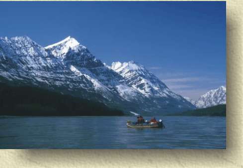 often be choked
with thousands of icebergs below Childs Glacier. The river ends in the Copper
River Delta, probably the most significant bird nesting and feeding area in
North America. As you journey down the river, you may encounter grizzly bears,
moose, caribou, wolf and bison. Brown and black bears are often seen fishing
along the banks of the lower river or waiting for salmon in Abercrombie Rapids.
Seals become a familiar sight from Wood Canyon down to the mouth. They will
suddenly appear out of nowhere staring at the rafts with their large dark eyes.
Bald eagles are so commonplace on the lower Copper that you will quickly lose
count of them. Fishing is impossible on the Copper River itself due to the
glacial silt in the water, however at Chitina and Wood Canyon you will see many
native and subsistence fishermen dip netting for sockeye salmon or scooping them
from the river in the Athabascan fish wheels. A few freshwater streams flowing
into the Copper will have sockeye in pools at the mouth.
often be choked
with thousands of icebergs below Childs Glacier. The river ends in the Copper
River Delta, probably the most significant bird nesting and feeding area in
North America. As you journey down the river, you may encounter grizzly bears,
moose, caribou, wolf and bison. Brown and black bears are often seen fishing
along the banks of the lower river or waiting for salmon in Abercrombie Rapids.
Seals become a familiar sight from Wood Canyon down to the mouth. They will
suddenly appear out of nowhere staring at the rafts with their large dark eyes.
Bald eagles are so commonplace on the lower Copper that you will quickly lose
count of them. Fishing is impossible on the Copper River itself due to the
glacial silt in the water, however at Chitina and Wood Canyon you will see many
native and subsistence fishermen dip netting for sockeye salmon or scooping them
from the river in the Athabascan fish wheels. A few freshwater streams flowing
into the Copper will have sockeye in pools at the mouth.
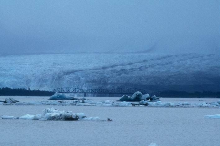
 The Copper River is one of Alaska’s
greatest historical waterways. The once famous railroad that carried millions of
tons of Copper Ore from the Kennicott Mine now lies abandoned and hardly noticed
except for the huge wooden trestles and occasional section houses seen along the
south bank of the river from the village of Chitina to the delta. Just above
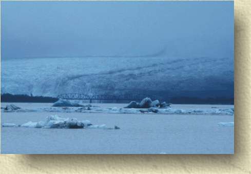
Cordova, the old railroad crosses over the river across the famous Million
Dollar Bridge that was partly destroyed and rendered useless by the 1964 Good
Friday Earthquake.
The Copper River is one of Alaska’s
greatest historical waterways. The once famous railroad that carried millions of
tons of Copper Ore from the Kennicott Mine now lies abandoned and hardly noticed
except for the huge wooden trestles and occasional section houses seen along the
south bank of the river from the village of Chitina to the delta. Just above
Cordova, the old railroad crosses over the river across the famous Million
Dollar Bridge that was partly destroyed and rendered useless by the 1964 Good
Friday Earthquake.
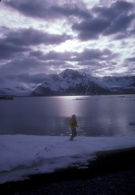
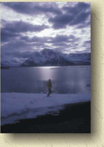
The wildlife is great
and the scenery is spectacular and the glaciers are fantastic, but the weather
can be extreme. If it is cloudy it will be cool and rainy. If it is sunny, you
can have ferocious winds every day starting about 2:00 to 3:00 that create huge
dust clouds. Also, warm sunny days create very high water a day or so later due
to glacier melting. Navigating the Copper can be challenging due to the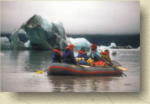 heavy glacial silt and difficulty telling deep water channels from shallow. The
only rapids you will encounter on this stretch are the whirlpools in Wood Canyon
(easily avoidable by staying left) and Abercrombie Rapids at the entrance to
Miles Lake. This rapid is unavoidable. At low water it is nothing but large swells. At
high water, after a few hot and sunny days which accelerate glacier and snow
field melting, it can look like big rapids on the Colorado with 15-foot standing waves.
It is not technical, no rocks, sometimes fishing bears but it can swamp you if
you catch a bad wave. We have never had a problem however.
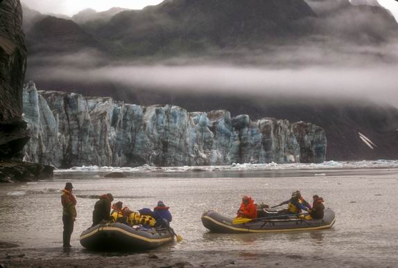
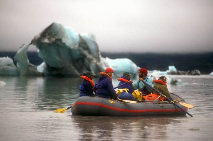
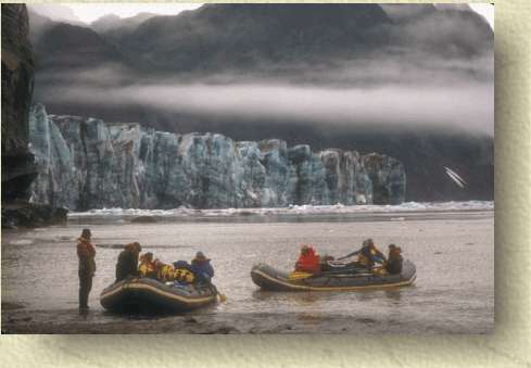
Paddling across Miles Lake and in front of the face of Miles Glacier and the
huge Child's Glacier is an incredible and sometimes humbling experience as you
maneuver through the strange and beautiful ice bergs floating downstream with
our boats.
heavy glacial silt and difficulty telling deep water channels from shallow. The
only rapids you will encounter on this stretch are the whirlpools in Wood Canyon
(easily avoidable by staying left) and Abercrombie Rapids at the entrance to
Miles Lake. This rapid is unavoidable. At low water it is nothing but large swells. At
high water, after a few hot and sunny days which accelerate glacier and snow
field melting, it can look like big rapids on the Colorado with 15-foot standing waves.
It is not technical, no rocks, sometimes fishing bears but it can swamp you if
you catch a bad wave. We have never had a problem however.
Paddling across Miles Lake and in front of the face of Miles Glacier and the
huge Child's Glacier is an incredible and sometimes humbling experience as you
maneuver through the strange and beautiful ice bergs floating downstream with
our boats.
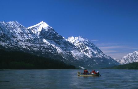
For a trip of 7 days or
less, I would recommend starting the float trip at the Klutina River near the
town of Glennallen. This stretch of river from Klutina to Chitina parallels the
Edgerton Highway. This is not wilderness, but it is wild country with beautiful
open hills and sage covered benches typical of the north side of the mountains.
This is also the stretch of river with the best chance of seeing grizzly bears
and bison. Two days later we will
reach the 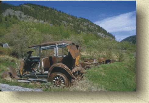 confluence of the Copper and the Chitina Rivers. Here lies the old
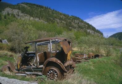
mining community of Chitina once the largest town in Alaska but now a ghost town
of 50 residents, old log cabins turned art houses and a handful of old Model T
Fords. A few miles below Chitina we enter Wood Canyon where we leave the road
system and enter into some spectacular mountain scenery. You are unlikely to see
another person from this point until you reach Flag Point on the Copper River
Delta and the dirt road leading to the town of Cordova. From Cordova you can fly
back to Anchorage or take the state ferry for a spectacular one and a half day
trip through Prince William Sound to Whittier. A quick trip on the Alaska
railroad through the Chugach Mountains and Portage Glacier and you are back in
Anchorage.
confluence of the Copper and the Chitina Rivers. Here lies the old
mining community of Chitina once the largest town in Alaska but now a ghost town
of 50 residents, old log cabins turned art houses and a handful of old Model T
Fords. A few miles below Chitina we enter Wood Canyon where we leave the road
system and enter into some spectacular mountain scenery. You are unlikely to see
another person from this point until you reach Flag Point on the Copper River
Delta and the dirt road leading to the town of Cordova. From Cordova you can fly
back to Anchorage or take the state ferry for a spectacular one and a half day
trip through Prince William Sound to Whittier. A quick trip on the Alaska
railroad through the Chugach Mountains and Portage Glacier and you are back in
Anchorage.
This float trip can be
done more economically than most Alaska rivers because no flying is involved. It
is the only river we run where we can actually drive to the put-in. Hiking is
not easy on this float due to the thick brush along the river. Once you reach
Miles Lake however, you can spend several days hiking and exploring the lower
glacier (actually walking on the ice) or the sand dunes and moraine fields below
the glacier.
RIVER
DATA: Total floating distance from Klutina to Flag Point:
136 miles. McCarthy to Flag
Point: 160 miles.
ROUTE:
Fly in to Anchorage then drive the Glenn Highway to Glennallen
and the Edgerton Highway to Chitina. From here we drive the McCarthy
Road 60 bumpy miles to McCarthy on the banks of the Kennicott River. We
will float the Kennicott River to the Nizina River to the Chitina River
finally arriving at the village of Chitina on the Copper River. !00
miles down the Copper River we will arrive at Flag Point in the Copper
River Delta. For a shorter variation of this trip we can start our float
where the Klutina River flows into the Copper River then float 36 miles
to Chitina and on to the Copper River Delta. From Flag Point we will be
picked up by van and driven 20 miles to Cordova where we will board the
state ferry at midnight and arrive in Whittier the next afternoon. Van
pickup or train 45 miles to Anchorage.
WEATHER:
Summer weather in South Central Alaska is generally good with warm days
and cool evenings. Rain can be expected at anytime especially later in
the summer. When it comes the rain usually sets in for a few days and
will produce a constant, soaking drizzle with wind and cool
temperatures.
On
the river, temperatures may range from as high as 80 degrees on calm,
sunny days to the low 50s or high 40s F on cloudy days. Beginning in mid
to late August you can expect freezing temperatures on clear, calm
nights warming to the 70s the following day. By mid September, daytime
temperatures can dip to near freezing and snow can be expected anytime.
Wind is a major factor on the Copper. Due to the weather extremes
between the warm interior of the upper river and the cooler coast at the
lower end of the river, pressure systems build by mid day (when the
temperature extremes are at their max) generating strong winds that blow
up the river valley. On many days, the boats can not float downstream
against these winds so we must make an early camp. The strong winds
create huge dust clouds that cover everything with wind-borne grit.